Site Planning & Development
Environmental regulations for energy operations continue to evolve and intensify, creating significant operational and financial risks. Traditional compliance monitoring relies on manual sampling, sporadic inspections, and paper-based documentation that can miss critical issues and create gaps in reporting. Our drone-based environmental compliance solutions provide continuous, comprehensive monitoring that strengthens your regulatory position and protects your operations.
Solutions for Site Planning & Development
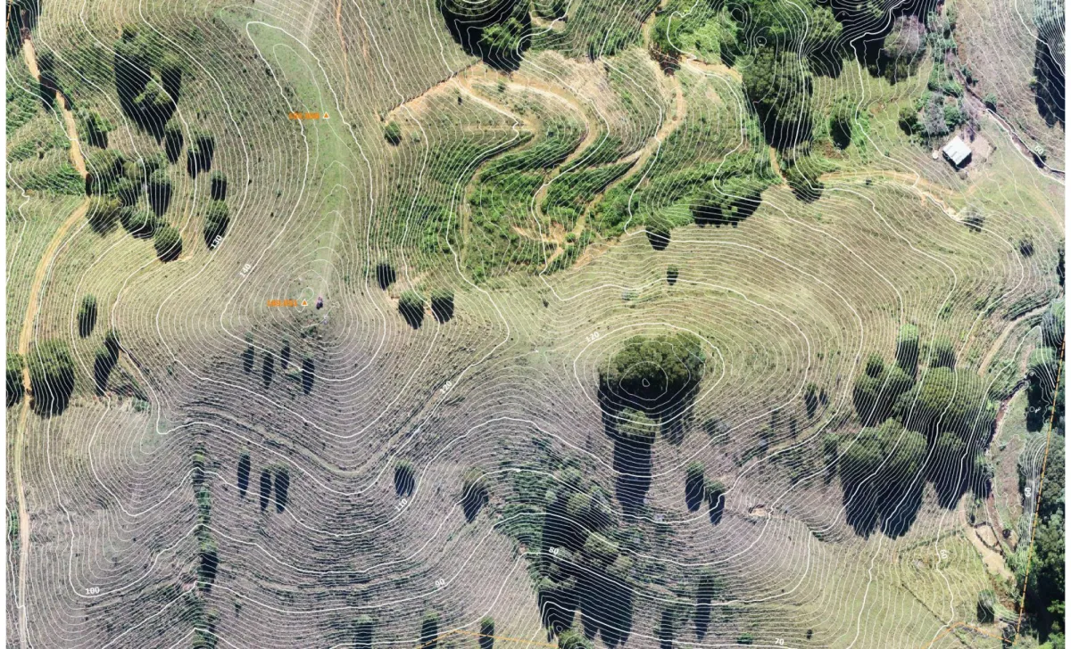
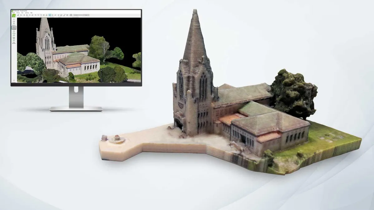
Aerial Topographical Mapping
Our precision aerial mapping technology creates highly accurate digital representations of your project sites.
Comprehensive Site Visualization
We capture complete site conditions including terrain features, existing structures, and access routes in a single survey
Centimeter-Level Accuracy
Our survey-grade mapping exceeds traditional methods in both precision and coverage area
3D Terrain Modeling
We generate detailed digital elevation models that inform optimal facility placement and earthwork planning
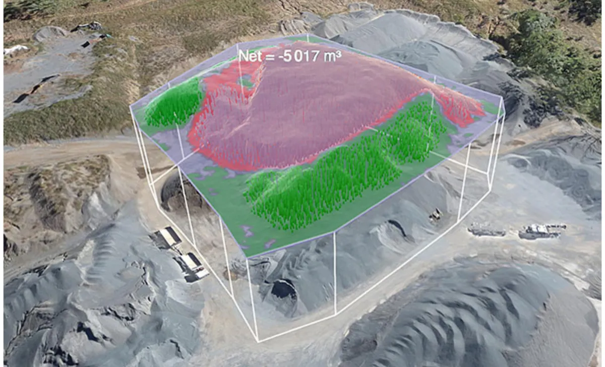
Volumetric Analysis & Modeling
Our advanced data processing transforms aerial imagery into actionable planning tools.
Cut/Fill Calculations
Precise volume measurements help optimize site preparation and reduce earthwork costs
Stockpile Monitoring
Accurate tracking of material volumes throughout project development
Drainage Assessment
Detailed terrain analysis identifies natural water flow patterns to inform stormwater management design
Change Detection Analysis
Sequential surveys document site changes over time, providing defensible evidence of compliance activities
How Our Solutions Work
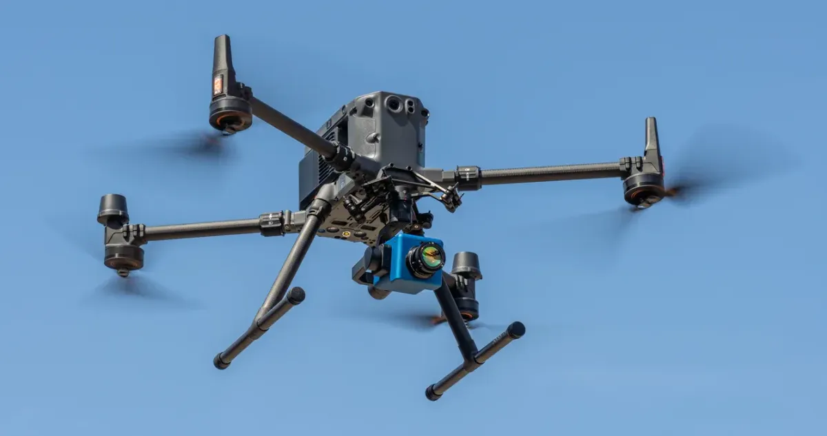
Advanced Detection Technology
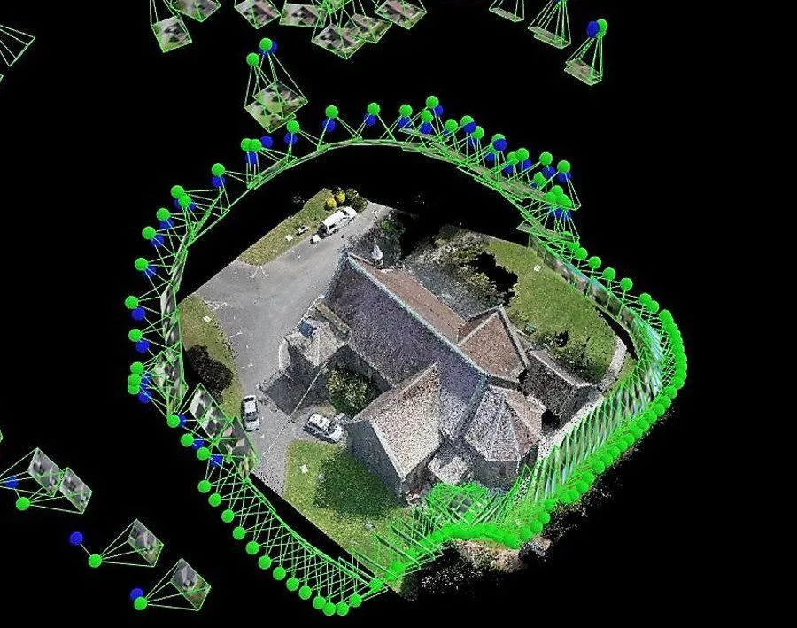
High-Resolution Photogrammetry
Multiple overlapping aerial images processed to create detailed orthomosaic maps and 3D models of your site
Survey-Grade Lidar Systems
Precision laser scanning penetrates vegetation to map bare earth terrain with exceptional accuracy
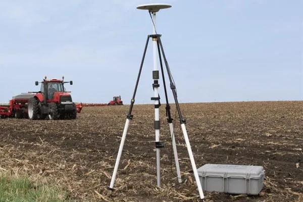
RTK/PPK GPS Integration
Real-time and post-processed kinematic positioning ensures centimeter-level accuracy across all collected data
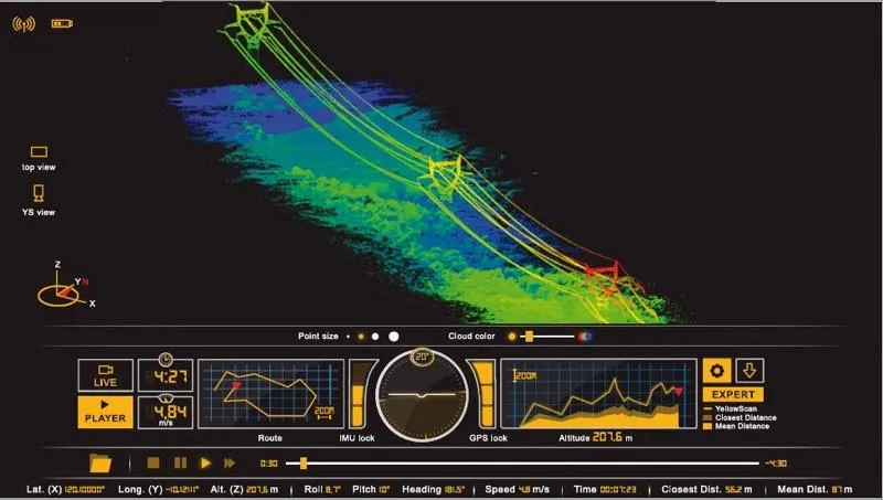
Cloud-Based Processing
Powerful computing resources convert raw data into detailed site models within hours of collection
Action-Oriented Deliverables
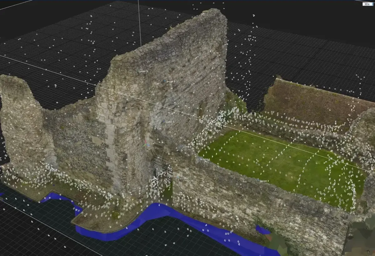
Interactive Site Models
Comprehensive digital platform organizing all environmental data geospatially for easy reference during inspections or audit

Planning Optimization Reports
Data-driven recommendations for facility placement, access routes, and earthwork planning
CAD-Ready Exports
Survey data formatted for direct import into AutoCAD, Civil 3D, and other common design platforms

GIS Data Packages
Comprehensive geospatial datasets compatible with ESRI, QGIS, and other GIS platforms
Why Work With Us

25+ Years Experience
in Energy Sector

Part 107 Certified
Drone Pilots

Professional Land Surveyor
(PLS)

OSHA
Safety Trained
How It Works
After you contact our team we will go over all details with you and determine when & where the project will take place. We will also determine what data will be collected & what reports will be sent to you prior to the project.
Our Goal
RidgeIQ aims to offer cost-effective solutions without sacrificing precision or data accuracy. Our expert pilots have been flying UAVs for 10+ years & have all of the field-experience to complete any project you might take on.
© 2025 RidgeIQ. All rights reserved.